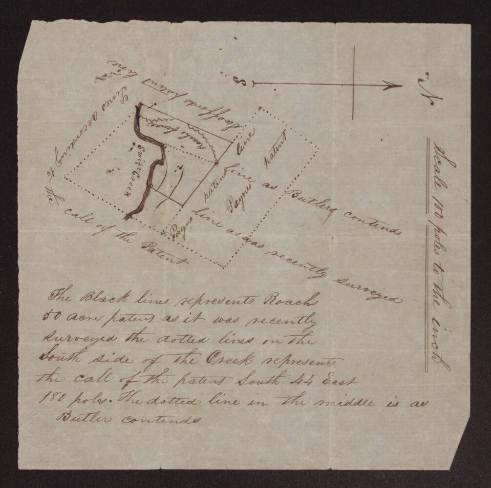
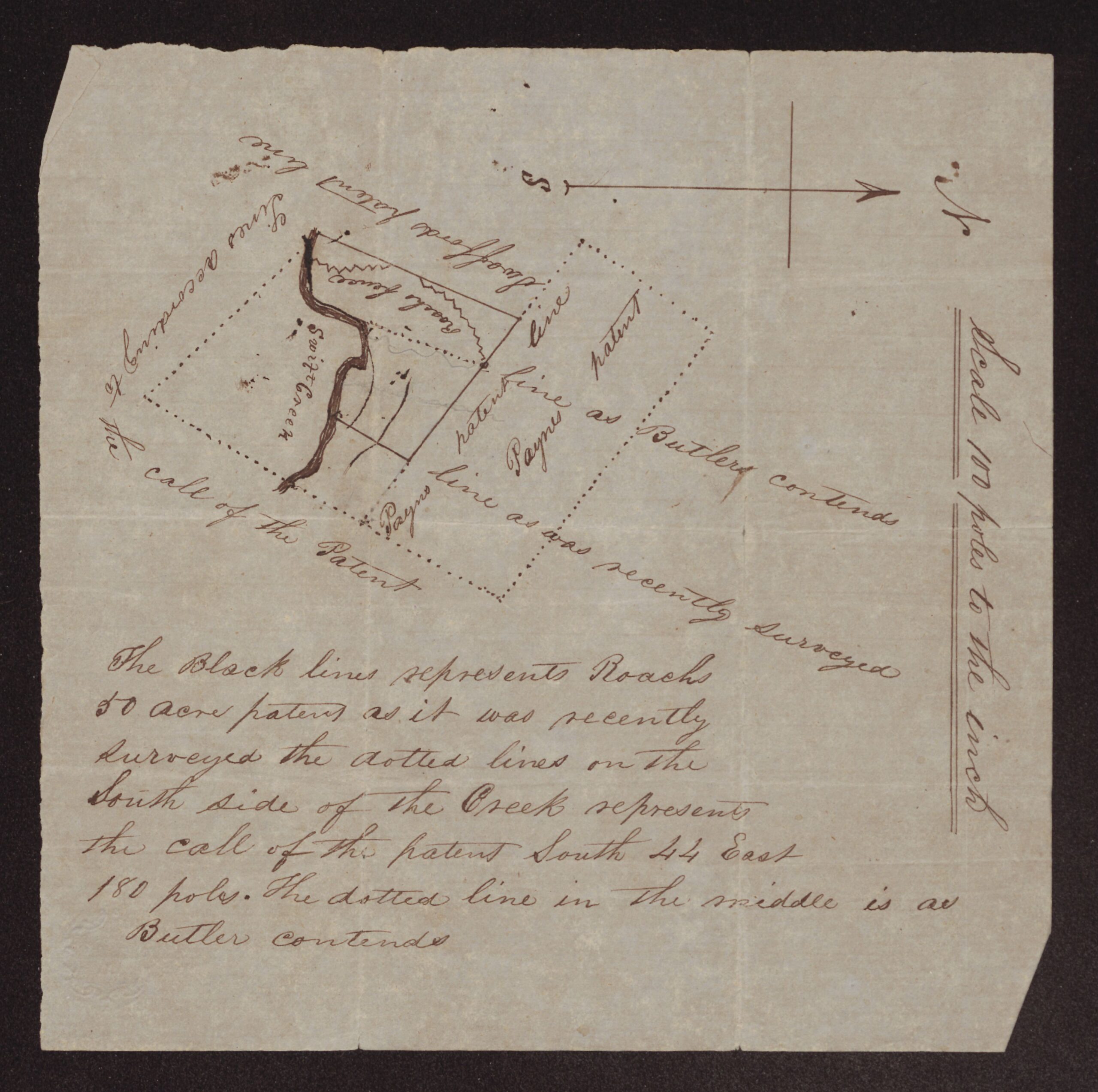
This undated plat shows Roach’s 50-acre patent on Swift Creek, called “The White Marsh” on the outside. The neighbors drawn on it are Swafford’s patent line and Payne’s patent, and a road fence runs across the land. Three versions of Payne’s patent line are drawn: as recently surveyed, as Butler contends, and as the patent calls for (south 44 east 180 poles). The scale is 100 poles to the inch.
There is no date, surveyor, signature or witness, and the given names of Roach and Butler are not written. It seems to have been made for a boundary dispute between a Roach and a Butler. The writer’s own words are kept as written below.
Plat of Roach’s 50-acre White Marsh patent on Swift Creek, showing Payne’s patent line as surveyed and as Butler contends – undated
Transcription notes: spelling, capitalization and punctuation follow the original. Words in [square brackets] are editorial notes; [?] marks an uncertain reading and [illegible] marks words that could not be read.
[Plat. Labels on the drawing:]
N [north arrow; S at the other end]
Swafford patent line
Road fence
Swift Creek
Paynes patent line
Paynes patent
Lines according to the call of the Patent
Paynes line as Butler contends
Paynes line as was recently surveyed
Scale 100 poles to the inch
The Black lines represents Roachs
50 acre patent as it was recently
surveyed the dotted lines on the
South side of the Creek represents
the call of the patent South 44 East
180 poles. The dotted line in the middle is as
Butler contends
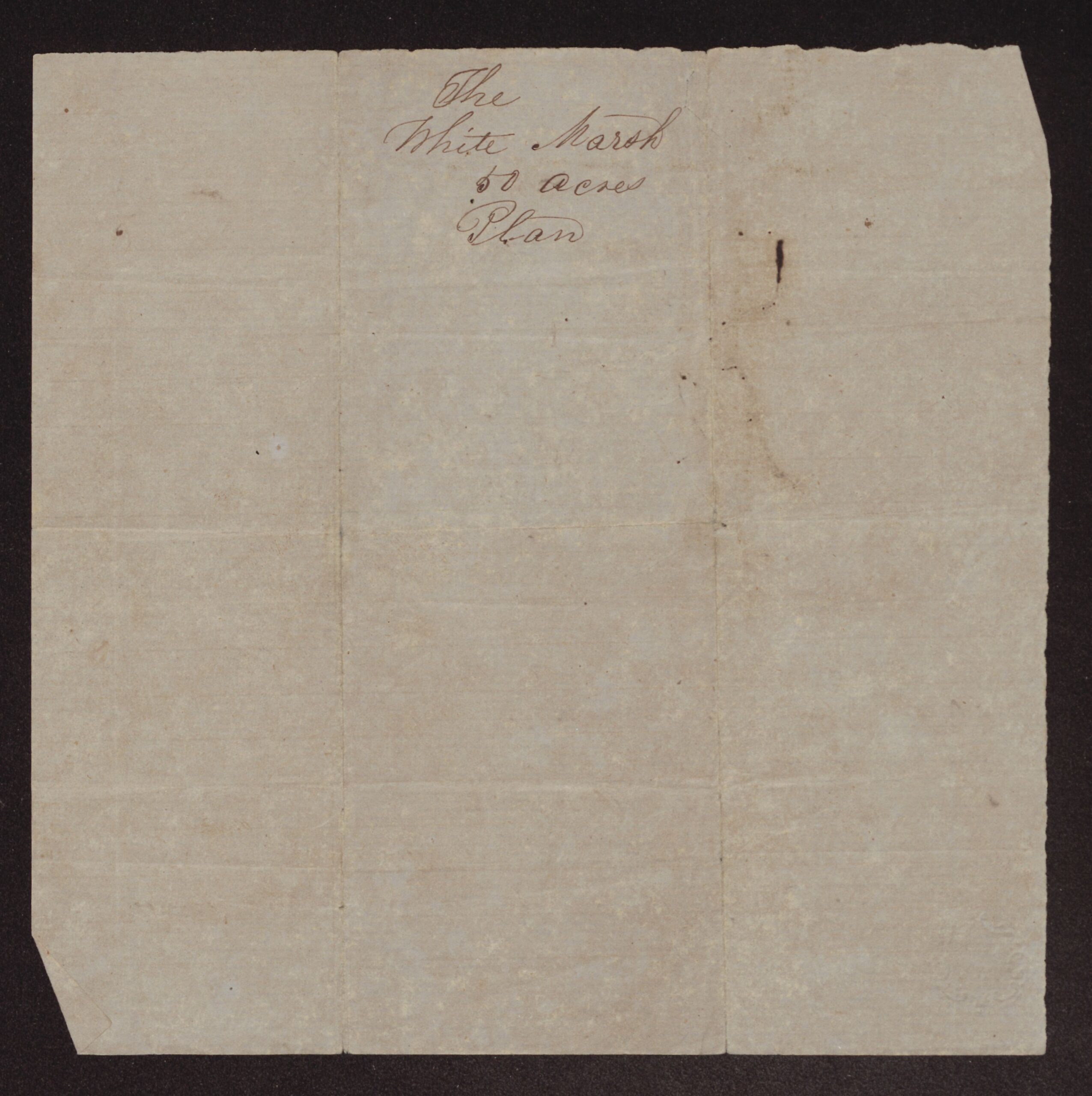
[Outside:]
The
White Marsh
50 acres
Plan
About the original
A plat drawn in ink on a single sheet, with the explanation written below the drawing and a short label on the outside. It has no date, surveyor’s name or signature.
The drawing shows Roach’s 50-acre patent on Swift Creek, bounded on one side by Swafford’s patent line, with a road fence running across it. Three versions of the line of Payne’s patent are drawn: as recently surveyed, as Butler contends, and as the patent’s own call runs. The plat seems to have been made for a boundary dispute between a Roach and a Butler.
The given names of Roach and Butler are not written. Swafford’s patent and John Payne’s line are the same neighbors named in Thomas Swafford’s 1756 survey and his 1778 deed to Charles Roach. The Butler deeds in this folder (1807, 1812 and 1816) concern land near Swift Creek, the White Marsh and the old John Paine patent, but this plat cannot be tied to any one of them.
Source: Plat of Roach’s 50-acre White Marsh patent, undated. Roach Family Papers (#346), East Carolina Manuscript Collection, J. Y. Joyner Library, East Carolina University, Greenville, NC, Box 1, Folder c (Land Records, 1728–1886). Collection guide. Digitized folder: ECU Digital Collections, 0346-b1-fc.
Images courtesy of East Carolina Manuscript Collection, J. Y. Joyner Library, East Carolina University. View this item in ECU Digital Collections.
Part of the Roach Family Papers collection on East Carolina Roots.