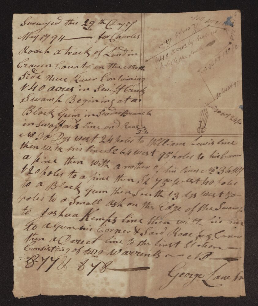
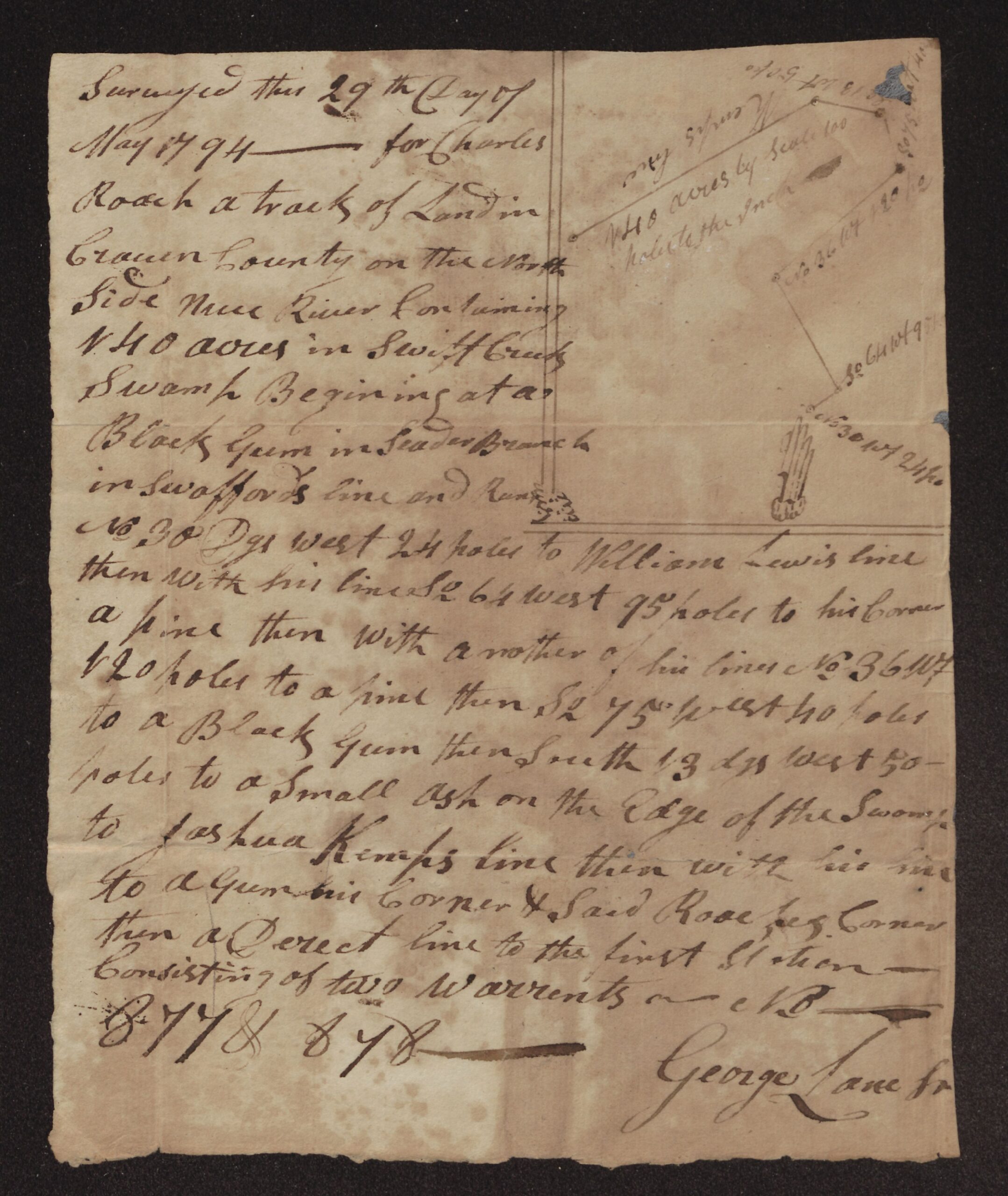
This survey was made on May 29, 1794, for Charles Roach. It covers 140 acres in Swift Creek Swamp, on the north side of the Neuse River in Craven County, and was made on two warrants, numbered 877 and 878. The land began at a black gum in Seader [Cedar?] Branch in Swafford’s line. It ran along William Lewis’s lines, then to Joshua Kemp’s line, and on to a gum that was Kemp’s corner and Roach’s corner.
Neighbors named are Swafford, William Lewis, Joshua Kemp, and Roach himself. A survey has no witnesses; it is signed by George Lane Sr. [?], and the plat is drawn on the same sheet. The writer’s own words are kept as written below.
Survey for Charles Roach, 140 acres in Swift Creek Swamp, north side of Neuse River – Craven County, 1794
Transcription notes: spelling, capitalization and punctuation follow the original. Words in [square brackets] are editorial notes; [?] marks an uncertain reading and [illegible] marks words that could not be read.
Surveyed this 29th Day of
May 1794 —— for Charles
Roach a tract of Land in
Craven County on the North
Side Nuse River Containing
140 acres in Swift Creek
Swamp Begining at a
Black Gum in Seader [?] Branch
in Swaffords line and Runs
No. 30 Dgs West 24 poles to William Lewis’s line
then with his line So. 64 West 95 poles to his Corner
a pine then with a nother of his lines No. 36 W.t
120 poles to a pine then So. 75 West 40 poles
to a Black Gum then South 13 dgs West 50
poles to a Small Ash on the Edge of the Swamp
to Joshua Kemps line then with his line
to a Gum his Corner & said Roach’s Corner
then a Derect line to the first Station ——
Consisting of two Warrents ———— C.B. [?]
877 & 878
George Lane Sr. [?]
[Plat beside the text. Along its lines:]
No 30 W 24 po
So 64 W 95 po
No 36 W 120 po
So 75 W 40 po [?]
So 13 W 50 po
140 acres by Scale 100 poles to the Inch
W. Lewis’s line [?]
About the original
This survey has its own plat, drawn on the same sheet.
“Seader Branch” probably means Cedar Branch. “Roach’s” is written as an abbreviation. The initials after “Warrents” are not clear.
The numbers 877 and 878 are probably the numbers of the two land warrants the survey was made on.
The surveyor’s name is read as George Lane Sr.; the last letters are uncertain. Two of the courses written along the plat’s lines are faint or worn.
Source: Survey for Charles Roach, 29 May 1794. Roach Family Papers (#346), East Carolina Manuscript Collection, J. Y. Joyner Library, East Carolina University, Greenville, NC, Box 1, Folder c (Land Records, 1728–1886). Collection guide. Digitized folder: ECU Digital Collections, 0346-b1-fc.
Images courtesy of East Carolina Manuscript Collection, J. Y. Joyner Library, East Carolina University. View this item in ECU Digital Collections.
Part of the Roach Family Papers collection on East Carolina Roots.